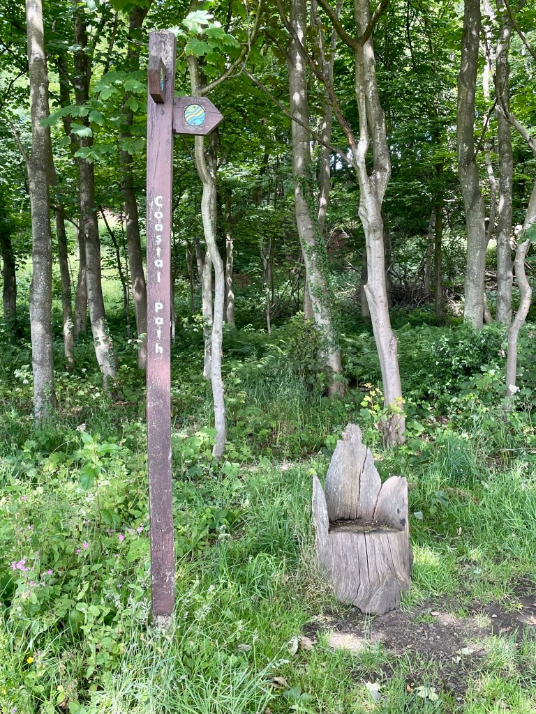
Our mission these next nine days will be to walk the Fife coastal path. For those who don’t hail from these parts, it pretty much ‘does what it says on the tin’. It’s a distance walking trail covering the coastal regions of the Kingdom of Fife. But, as you shall see, it’s not quite that simple…
I’ve walked parts of the path previously and know some areas of it very well. I had a caravan at Burntisland for some years, mainly for weekend use but I loved it so much that for two years I lived there permanently and commuted daily to Glasgow for work, a round trip of 110 miles. Friends and colleagues thought I was certifiable, until they visited and saw the views. But these first three days have shown me lesser known parts of the region – to be honest, not all ones I would rush back to – but today ended on a real surprise high note.
A few practical points first if I may. We chose to walk the route ‘bridge to bridge’ – that is starting at Kincardine (generally accepted by most as the starting point) and ending at the Tay Bridge. The path actually goes on to Newburgh, a further 18 miles beyond our intended end point. The main reason for this is our intention to try to walk the route continuously and the realisation (already, quite literally, painfully apparent!) that 14 miles in a day is about our maximum limit. The route we selected is a pleasantly round 100 miles so we need 9 days. Although we’re both retired we do actually do other things so trying to find 9 consecutive days to dedicate entirely to walking and recovering isn’t easy; in fact we have had to insert a day between days 8 and 9 due to a pre-existing commitment.
We live in Kinross, 30 minutes drive from the nearest points on the path and nearer an hour to the furthest away. Despite this, the appeal of being able to return home each day resulted in us choosing a ‘two-car solution’ whereby we drove both cars to the end point for that day, left one there and drove together to the starting point. After the walk we returned to the starting point to collect the second car. Not good for the planet, hands up to that one, sorry.
So, here are some general observations on the first three days before a description of each in more detail, with some pictures to break up the monotony. First, in case you didn’t know, walking 10 to 14 miles is hard. Well, it is for me. Ok, I’m neither young nor fit but I ache in places I didn’t know I had. And walking that distance day after day is harder. I did the West Highland Way many years ago, camping on the way and carrying a heavy backpack. I can’t remember it getting harder but that may simply be selective memory.
Next thing that hits me is much, in fact most, of the walking so far has not been along the coast. Now I realise, from common sense, research and talking to people who have done the path in part that it is necessary to walk alongside roads, along town streets, through woods, past fields but today we walked though a flour mill and a water treatment plant so it’s certainly diverse. we had about 5 miles continuous roadside walking yesterday and it gets a bit wearing after a while.
Now, I have planned pretty carefully for the walk – or so I thought – but there always seems that one thing you’ve overlooked. A backpack is pretty indispensable; mine has a flask of coffee, sandwiches, juice, a waterproof jacket. At various points already, I wished it had sunglasses, a hat, a spare tee shirt and (dangling from it) a pair of walking poles. Probably by day 8 I’ll have cracked the preparation part. It doesn’t help that the Scottish weather is being typically schizophrenic. Day 1 was at least consistent; when the rain began it just hung around. The last two days have been so changeable that trying to get layers of clothing right for temperature, wind, rain is a nightmare. It’s hard to avoid stopping every few minutes to shed or reacquire a layer, put on or take off a rain jacket….That’s why in some photos I look a bit like a demented cricket umpire.
So to the details of the first three days. Day 1 was Kincardine to Limekilns, 11.5 miles, 4 hours walking. Day 2, Limekilns to Aberdour, 14 miles, just over 5 hours. Day 3, Aberdour to Dysart, 13 miles, 5 hours.
Day 1 – Kincardine to Culross (4 miles) Culross to Limekilns (7 miles)
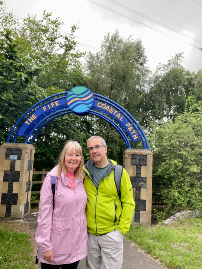
The start of the walk is marked by a gateway.
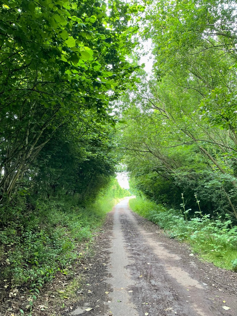
We had set off early, as the weather forecast was foreboding, but felt positive and energised as we made good time along a cycle way through pleasant woodlands.
After a few miles we could see Longannet power station, the last of the coal-fired plants which was decommissioned in 2016.
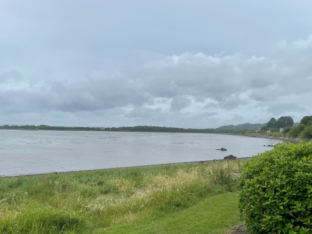
Soon we got our first glimpse of the coast at the Torry Bay Nature Reserve.
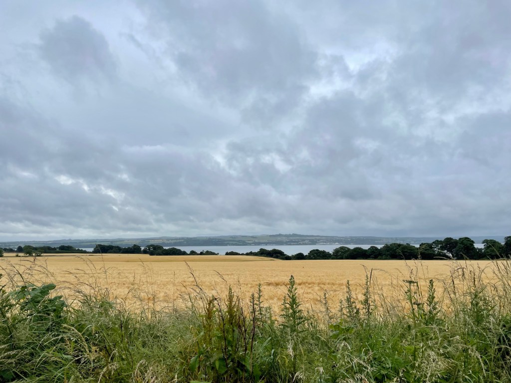
The path runs along the coast until reaching Culross, a historic village which we have visited before so did not divert to on this walk. Part of the reason for this was that the promised rain had arrived (as soon as we sat down and opened the thermos). After another woodland section came a rather dreary section pounding that pavements through Newmills into Torryburn. It was a relief to eventually escape and climb to a pleasant farmland scene, although the rain was a persistent niggle.
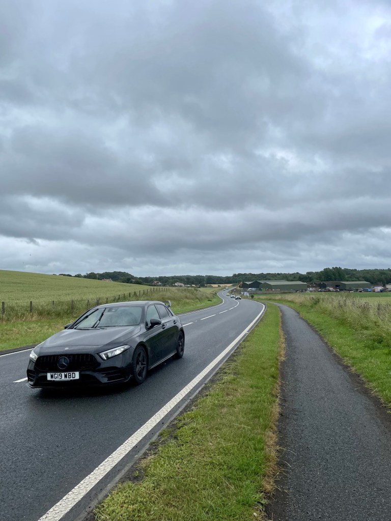
We emerged onto a busy road again, tiringly close to traffic.
After briefly escaping through the village of Crombie, it was back to a roadside cycle way all the way until the turn off for Charlestown and Limekilns. These historic villages made an attractive end to the walk, in particular the coast at Limekilns where the car was a welcome (and dry) sight.
Day 2 – Limekilns to Rosyth (2 miles) Rosyth to North Queensferry (3.3 miles) North Queensferry to Inverkeithing (2.5 miles) Inverkeithing to Dalgety Bay (2.1 miles) Dalgety Bay to Aberdour (3.6 miles)
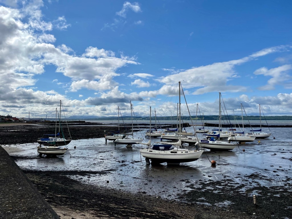
Limekilns is a pleasant start to your day, walking along the shore, looking at the boats and seaside houses with their gardens.
Soon we were turning away from shore and heading uphill through some woodland and alongside some arable land. In the distance we could see the giant crane and cruise liner that signify Rosyth dockyard.
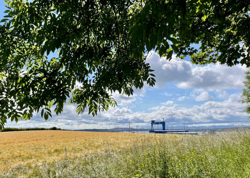
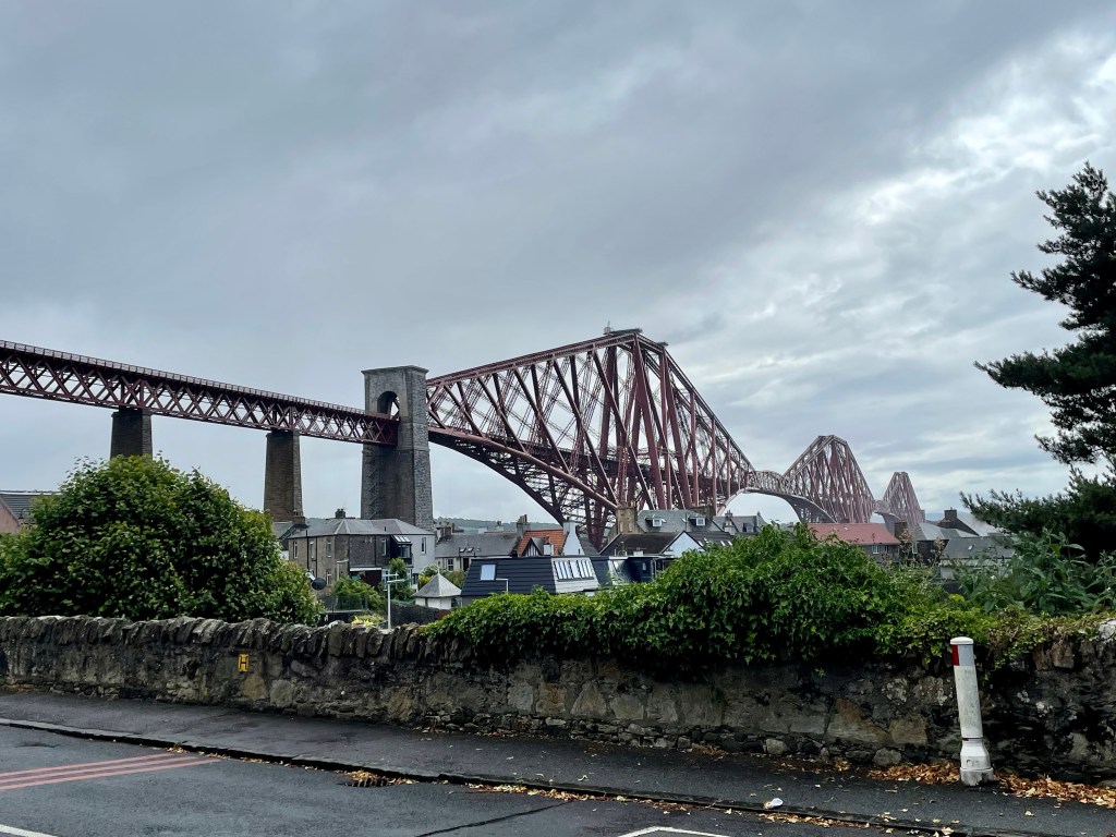
The thrum of traffic announced we had arrived at a busy road and for the next mile we were buffeted by the noise and wind of vehicles passing at speed. It was a relief to turn off into the streets of Rosyth but the townscape proved rather dreary (sorry to any local readers!) as we descended gradually towards the port area and a long stretch beside an almost disused road. The sight of the Queensferry Crossing gave hope that more interesting areas lay ahead, much needed as we were 6 miles into the walk.
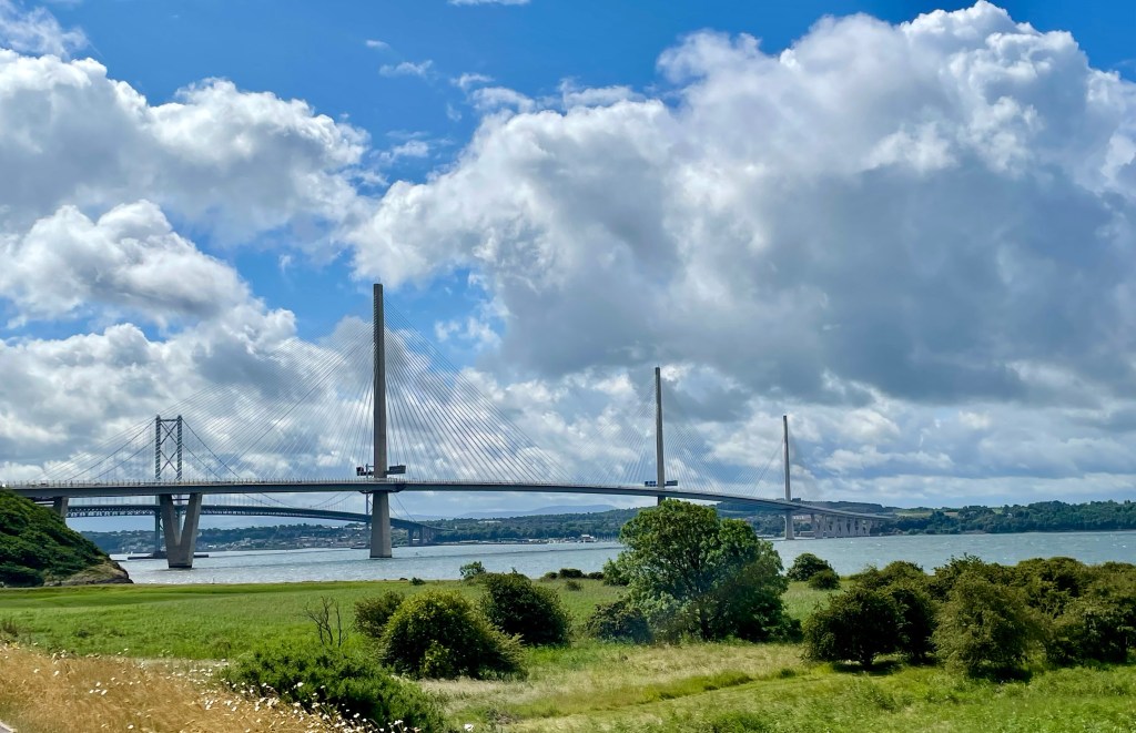
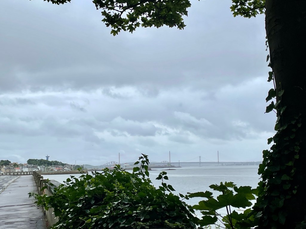
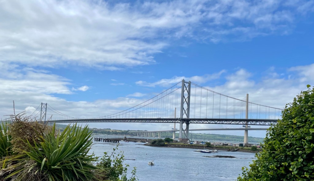
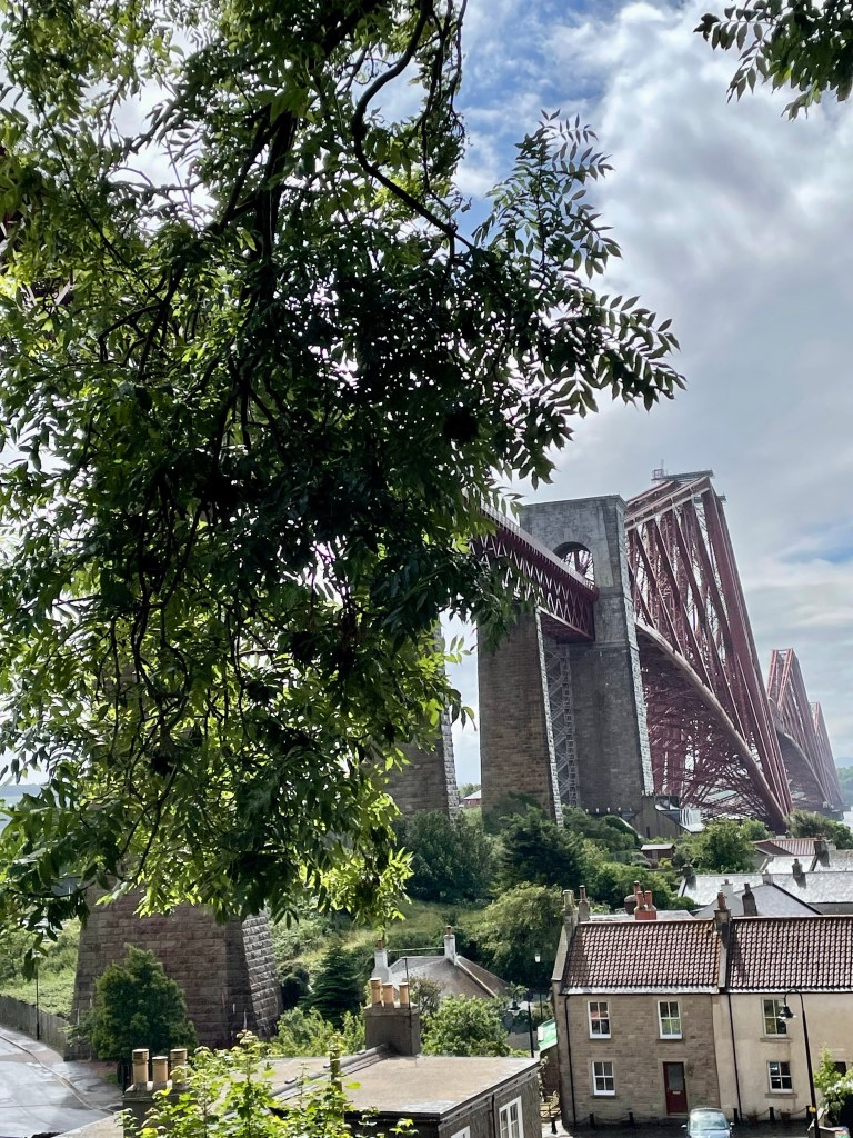
However, it was a long slog to North Queensferry yet and the gathering clouds finally released their rain just as we finally reached the town and dared to consider stopping and reaching for the coffee. It was a relatively short shower but sharp enough to metaphorically and literally put a damper on proceedings, but we still managed to appreciate the fine views of the three crossings. The rail bridge remains one of my favourite Scottish landmarks, an iconic structure which does our heritage proud.
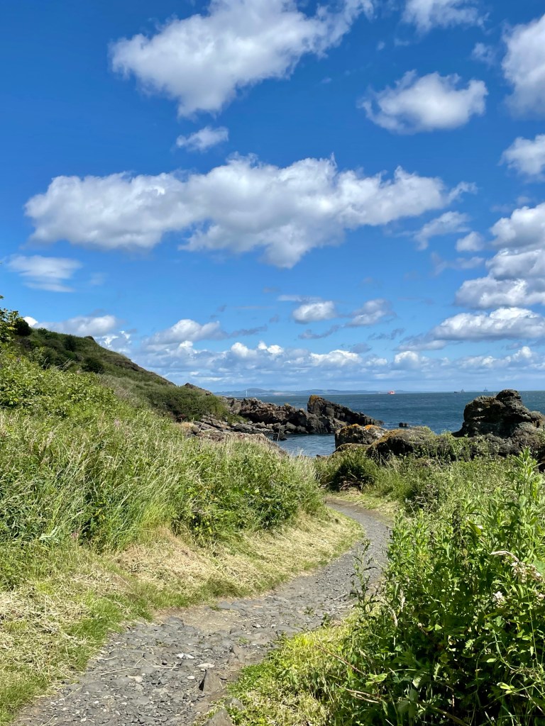
We had decided against the option of exploring the town, that can wait for another (sunnier) day, so instead took the path up to Carlingnose point which afforded some fine views in improving weather.
A gentle descent took us to a lovely little beach at Port Laing; we had some house envy at the lucky people with ideal kayak launching points literally at their back door.
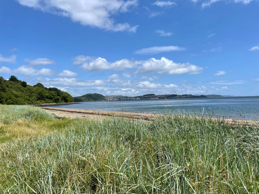
Across the bay the attractive red roofed houses of Dalgety Bay were now in view.
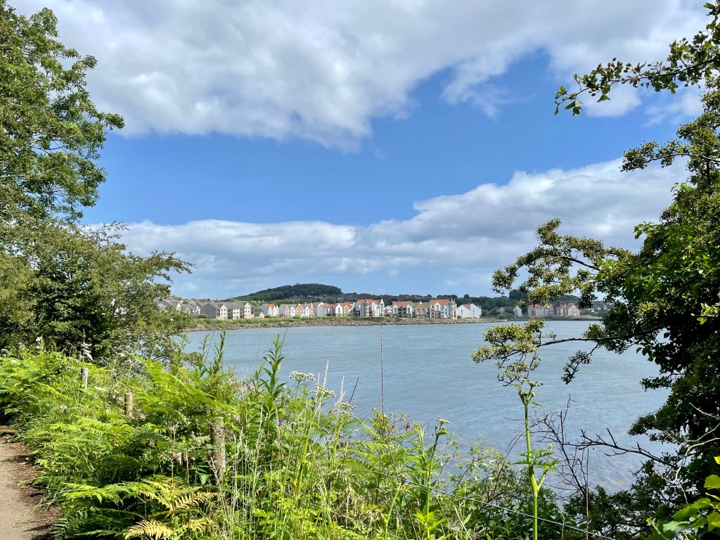
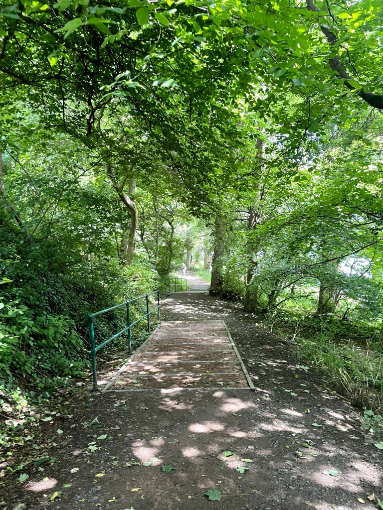
Before reaching there however, we had to circumnavigate the inner bay at Inverkeithing, where the quarry and metal recycling yard were further reminders of the quirky nature of the coastal path. Inverkeithing itself had some attractive buildings but herein lies another issues about this type of walking; by now, we were tiring rapidly and the understandable urge to explore lost out to the desire to push on to the end. The flats houses of St David’s Harbour in Dalgety Bay are impressive in appearance and, particularly, location, not only for the majestic sea views afforded by the elevated position, but also due to the delightful woodlands beyond them and within easy reach; we enjoyed walking through here after rounding Downing Point, especially as the route here was downhill.
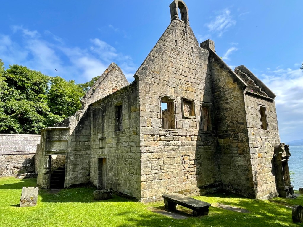
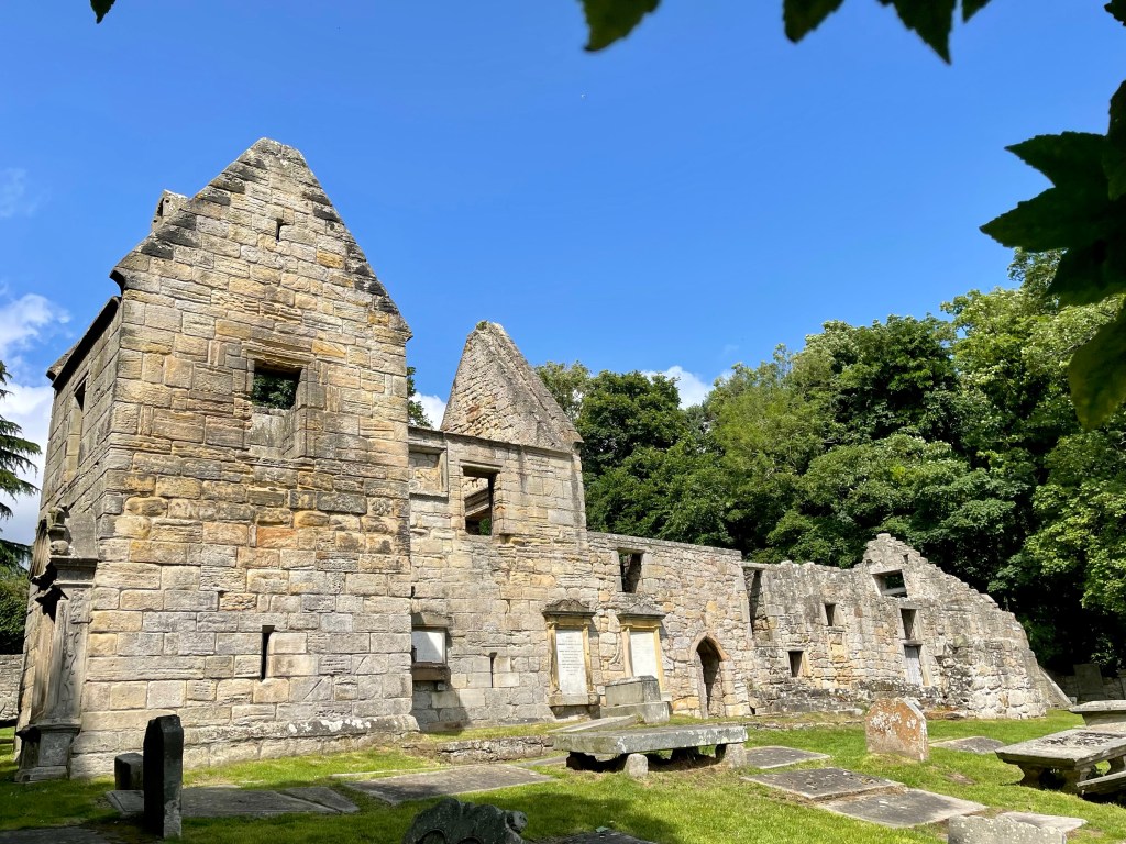
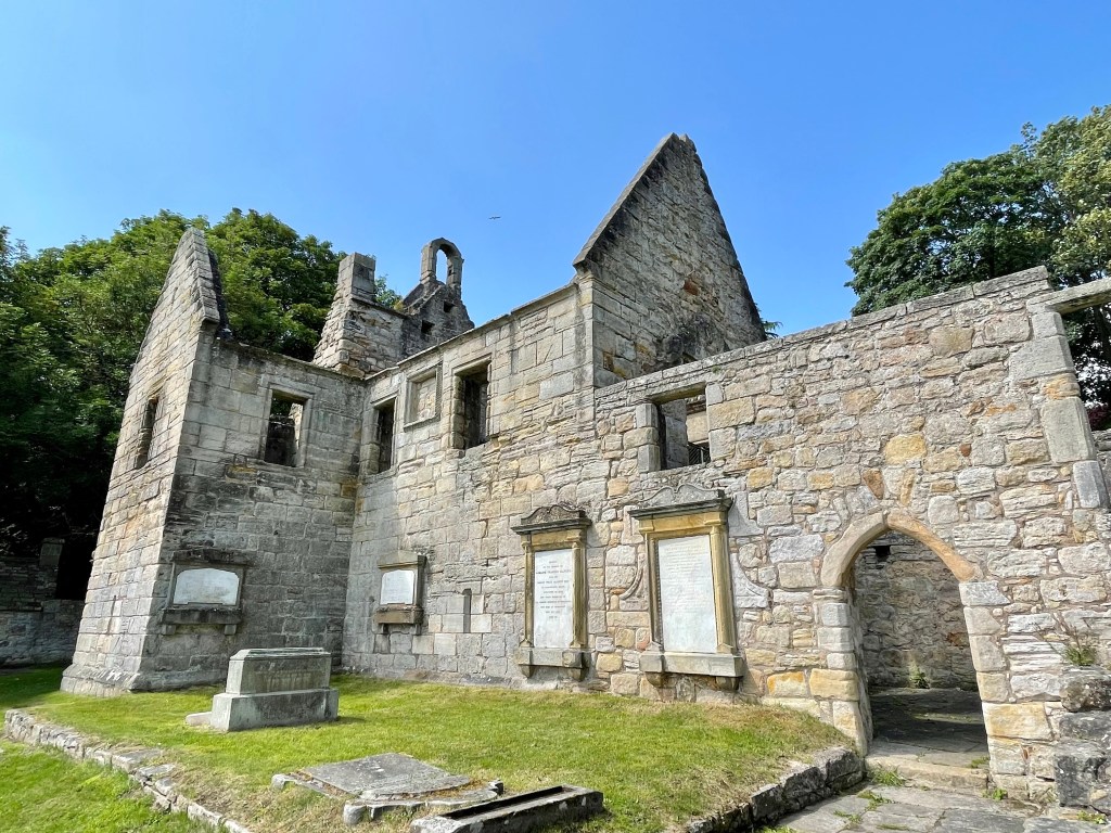
Suddenly, we were faced with a sharp uphill section and, groaning audibly, I set myself for a push, almost missing the beautiful sight of St Bridget’s Kirk! Thankfully, I registered what a picturesque location it occupies and took several minutes to explore the site, which gave me physical and, perhaps, spiritual, energy.
It was much needed, because the uphill section was lengthy and followed by another mile or more of footpath, in past Aberdour golf course, until finally we had arrived, exhausted but satisfied.
Day 3 – Aberdour to Burntisland (3.6 miles) Burntisland to Kinghorn (2.9 miles) Kinghorn to Kirkcaldy (3 miles) Kirkcaldy to Dysart (2.5 miles)
Now I found myself on very familiar ground from my days living here. I have even walked the sections from Aberdour to Burntisland and from Kinghorn to Kirkcaldy before and still visit the beaches at Kinghorn and Pettycur to kayak. This was a day I was very much looking forward to. However, we met an early hiccup when we encountered a sign at the start advising us that the path was closed due to a land slip and a diversion would be required. Having trudged back uphill to the main road I couldn’t help but think it would have been more thoughtful to place the sign at the top of the road!
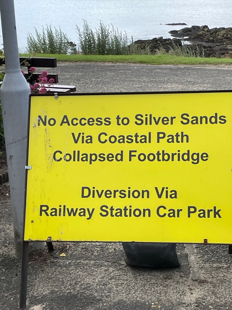
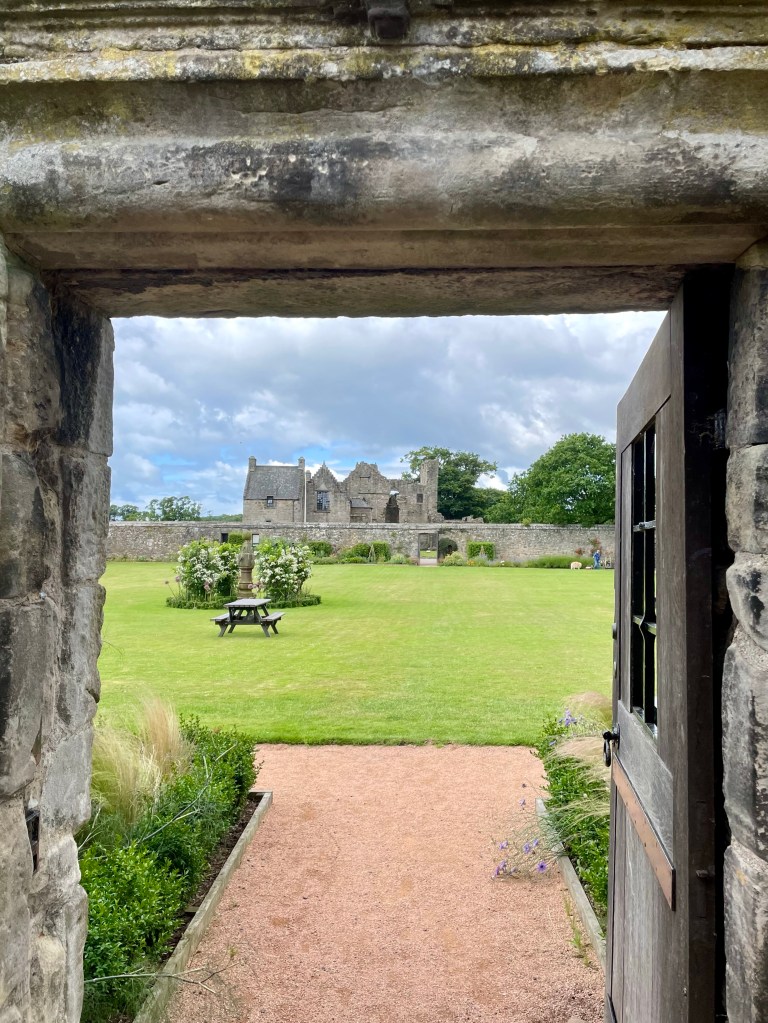
We passed by the entrance to Aberdour castle before heading to Silver Sands.
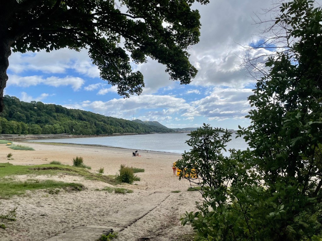
The beach at Aberdour is a favourite spot for us and always reminds us of Moira’s beloved labrador Lexi, who loved this spot.
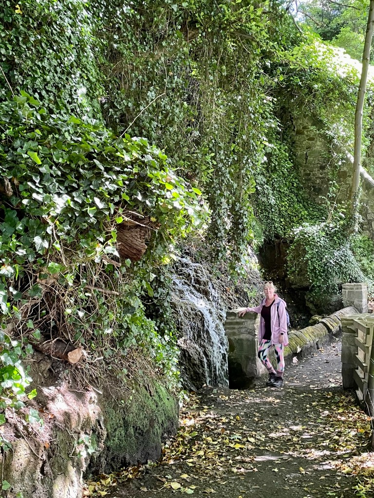
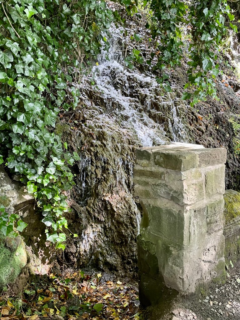
Having eaten in the lovely cafe at the end of yesterday’s walk, we simply strode on by, accessing the path alongside the railway and water’s edge en route to Burntisland. The waterfall at Starley burn was less than in full spate due to the relatively dry weather but still made an agreeable stop.
Soon we reached Burntisland and reminisced as we walked along the main street, through the summer fairground which was gathering apace and onto the seafront, where we stopped for a coffee.
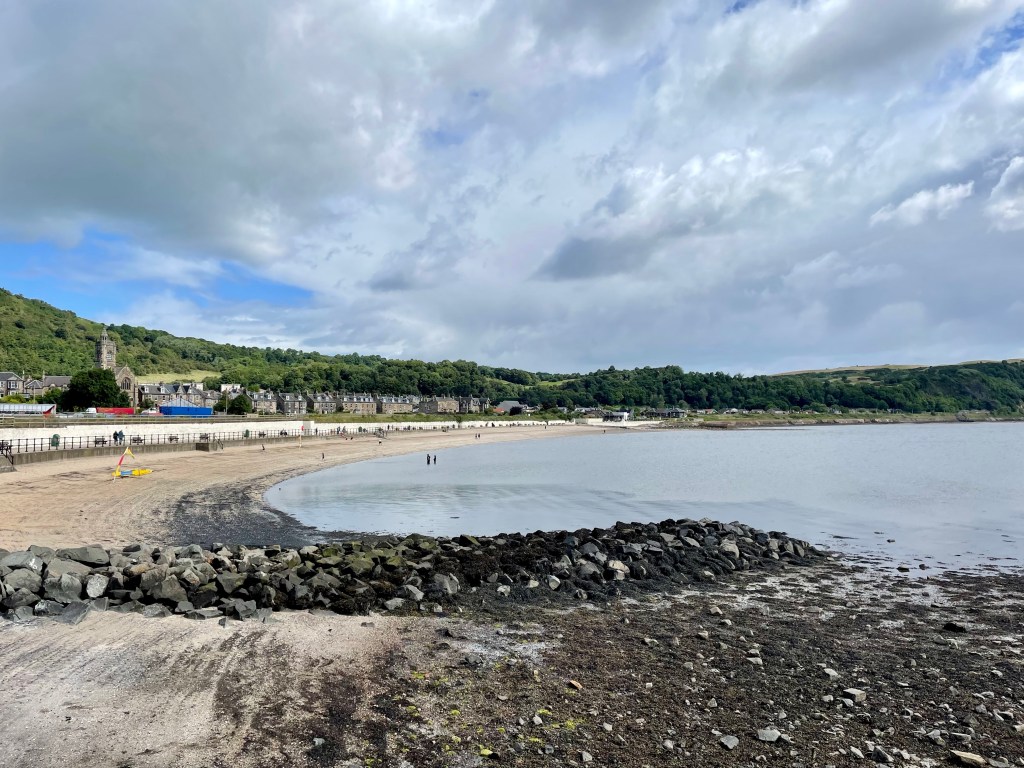
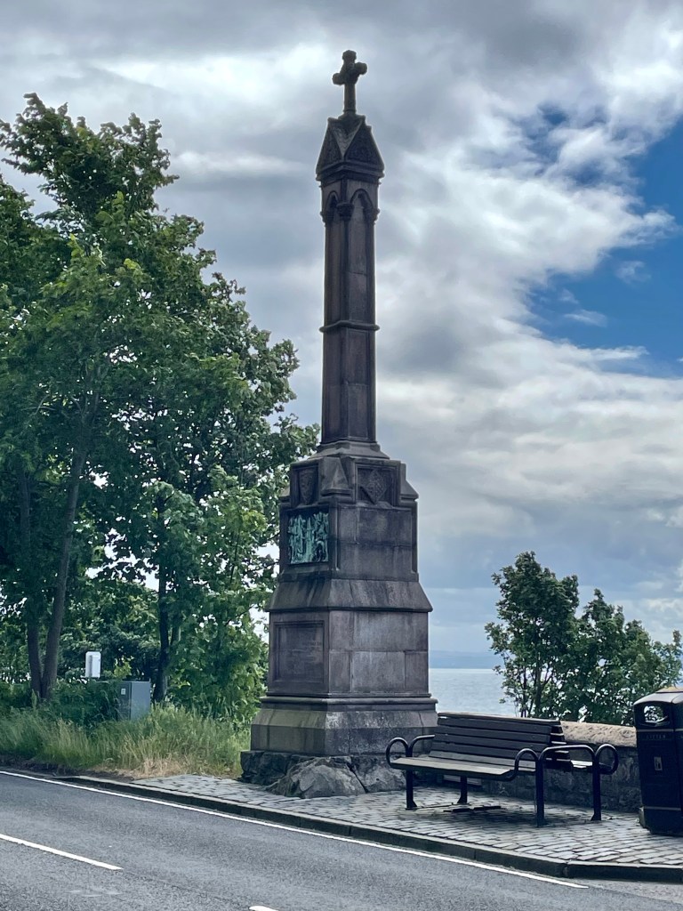
The tide being high, the option to walk across the sand was off the table so we headed inland and along the road up past the monument to Alexander III, who fell to his death here, and Pettycur Bay Holiday Park then into Kinghorn.
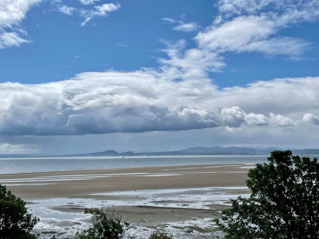
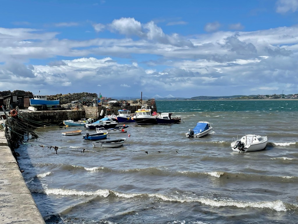
Steps took us down to the small sandy beach and harbour.
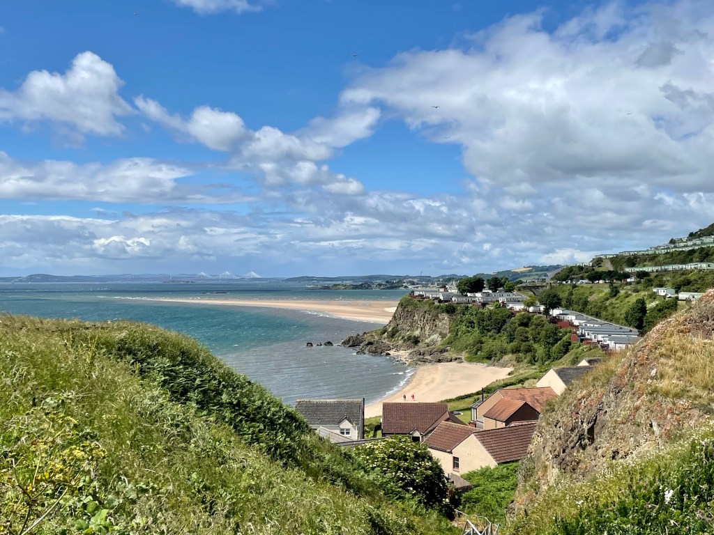
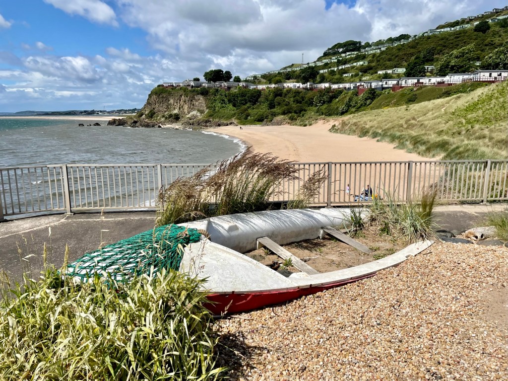
From here, we headed round to the other beach.
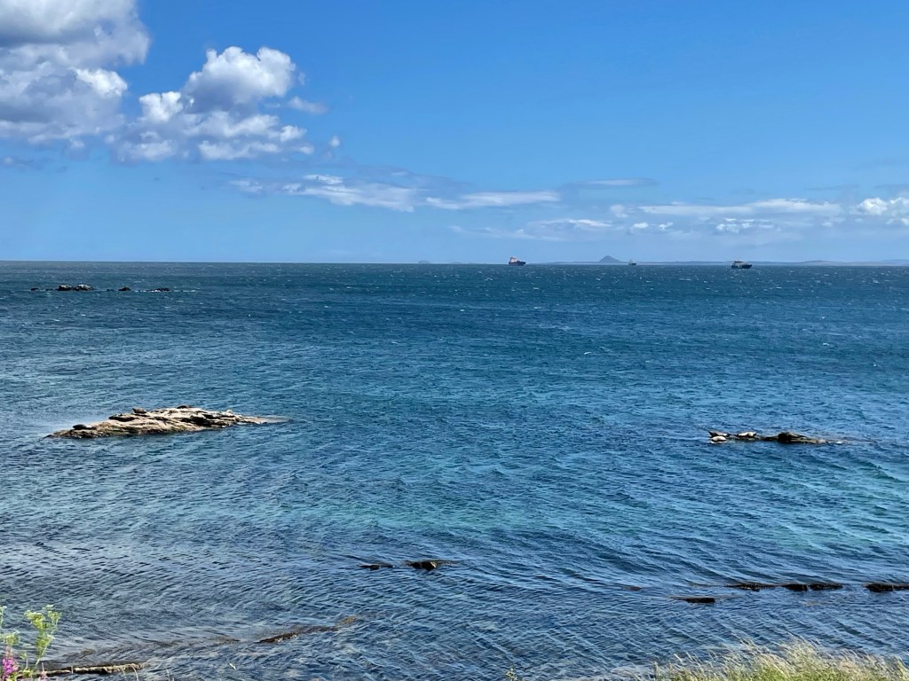
The path then ascends through a park to reach the path to Kirkcaldy. Seals were basking on the rocks.
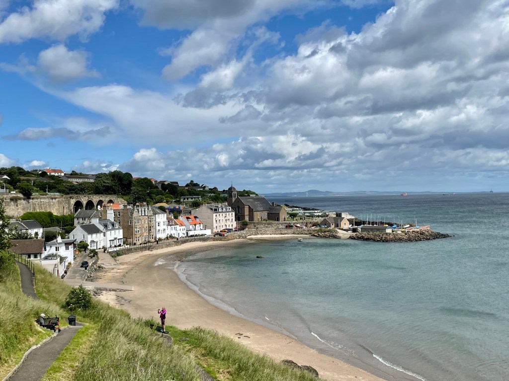
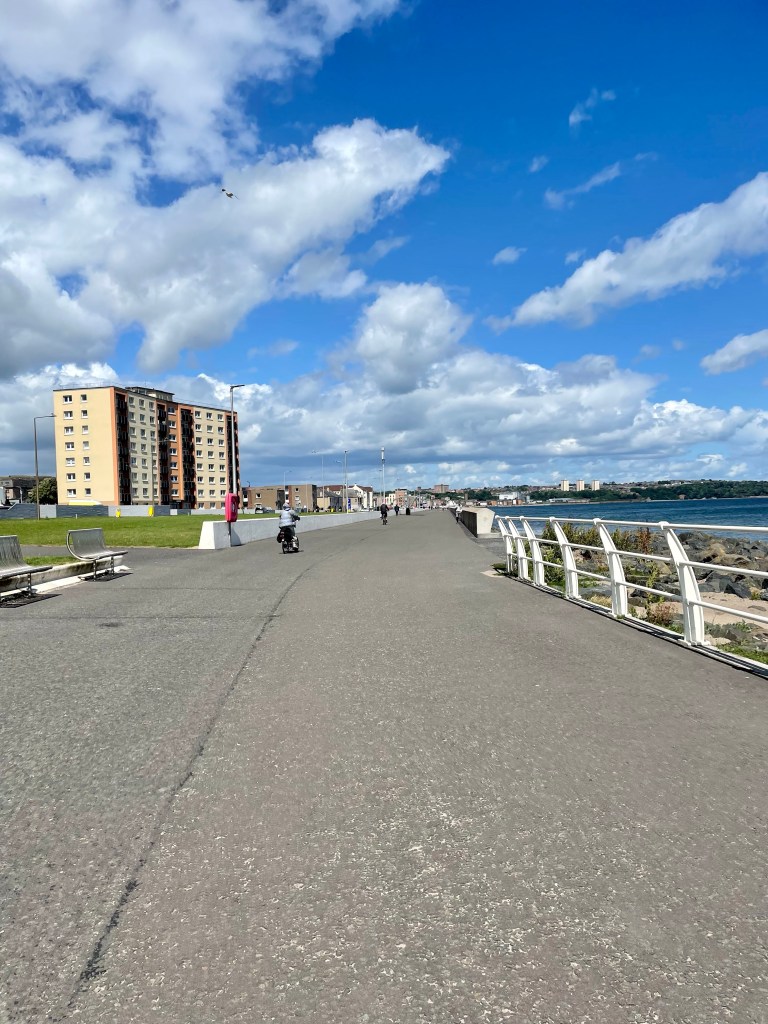
Kirkcaldy is known as ‘the lang toun’ (‘long town’) and the promenade certainly lives up to the name.
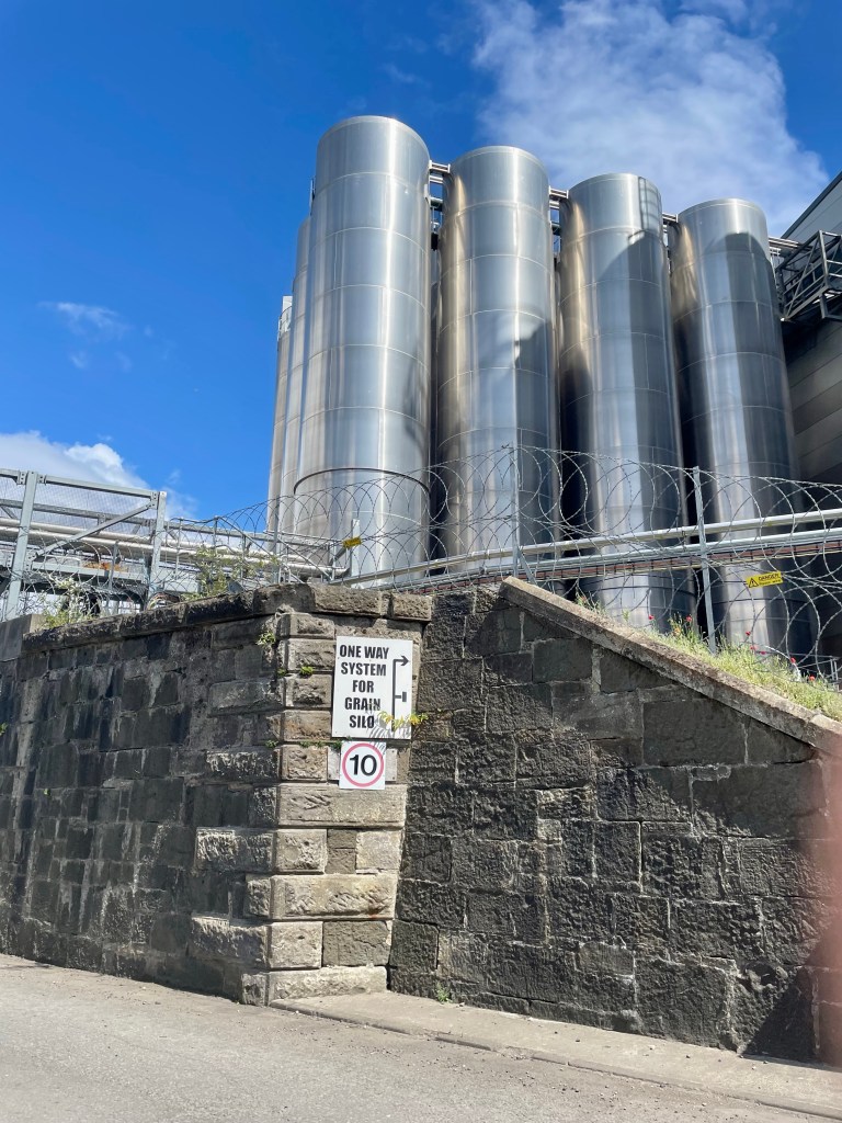
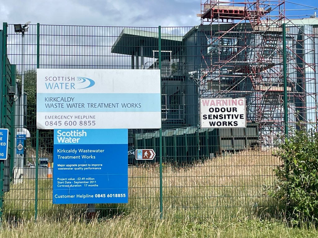
At its far end, the path rather bizarrely diverts through a flour mill and past a water treatment works (thankfully not generating the advertised aromas!)
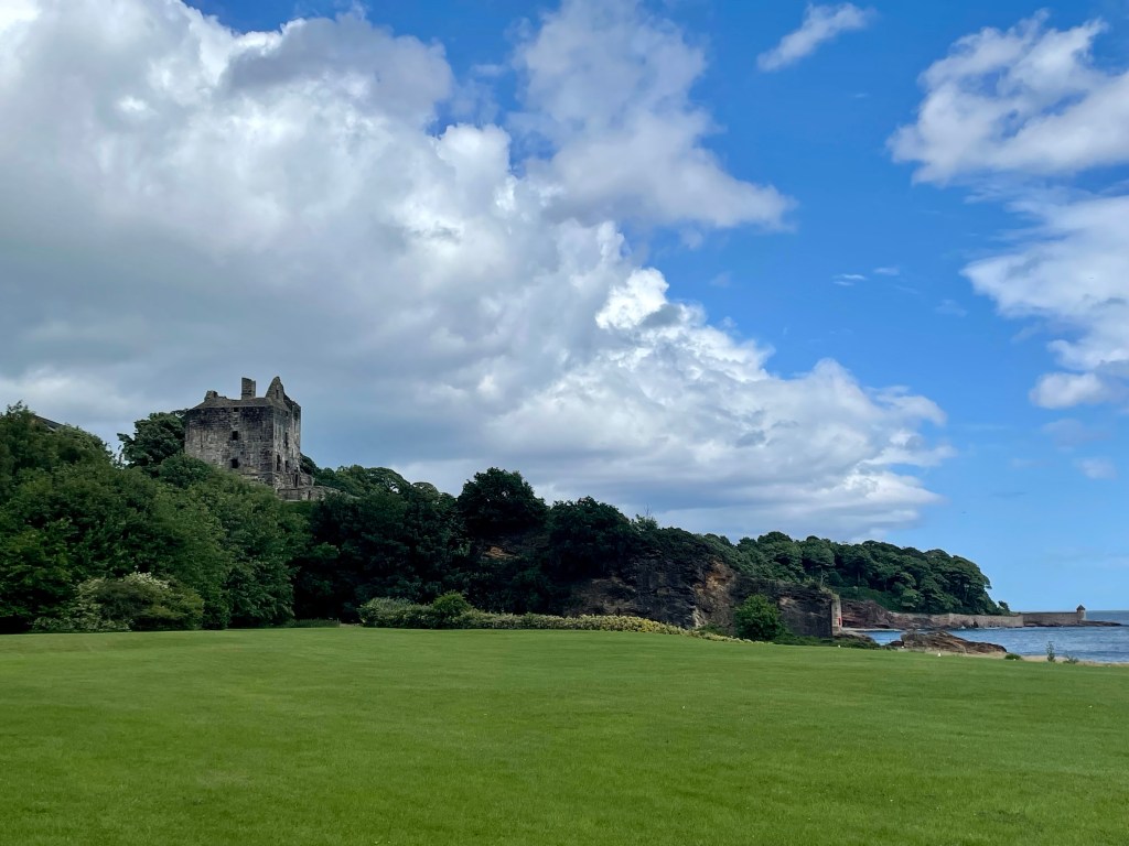
More pleasant surroundings were found in Ravenscraig park where the castle stands guard.
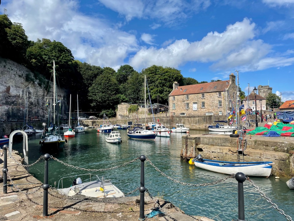
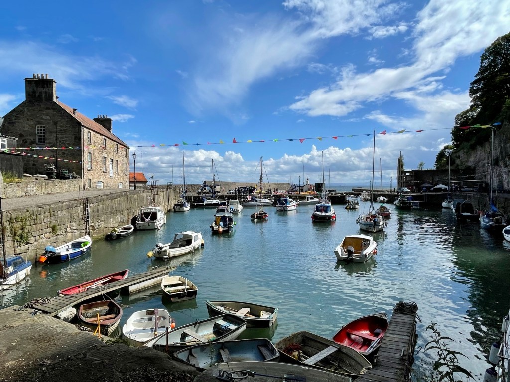
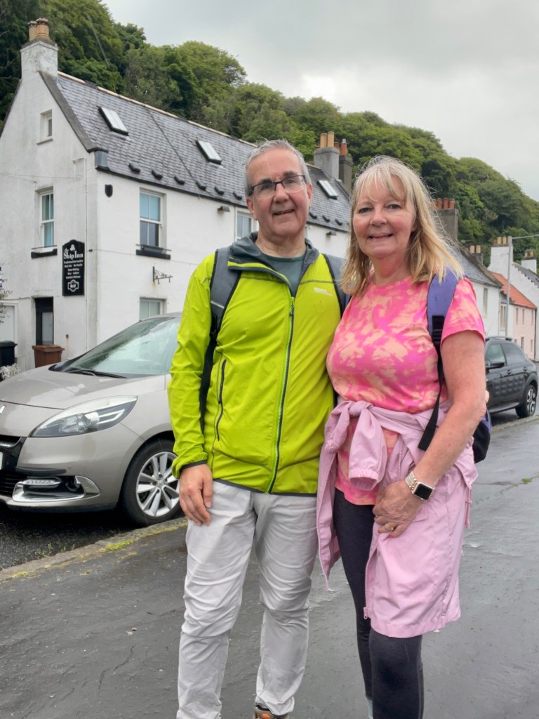
A path took us to Dysart, which proved a delightful end to a lengthy walk. The delightful harbour was used in the series ‘Outlander’ and more than holds its own against the better known and more vaunted East Neuk villages which await us in the days to come.